Crossing the Tay
Dublin Core
Title
Crossing the Tay
Description
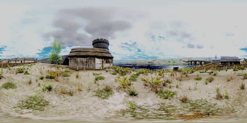
The River Tay is the largest river in Scotland. It transports a lot of water and it can swell and be very strong. Here at Perth is the lowest and safest crossing point before the sea. Over the centuries, the people of Perth have tried several times to build bridges over the Tay which were sadly often swept away again in strong floods. Ferrymen between here and Kinnoull on the other side of the river were busy transferring people and goods in often dangerous currents and atrocious weather conditions. Several bridges at Perth were built over time, and swept away again in times of strong and high floods. In 1209 a flood also destroyed Perth Castle which stood where the Horsecross Concert Hall is today in George Street behind you. To carry people and goods over the Tay, many ferrymen worked in Perth until the new bridge was built. It was dangerous and arduous work to steer against the strong currents and know the best routes across without losing your cargo or risking lives. The present bridge you see before you was built in 1771 by John Smeaton and is the oldest of the bridges in Perth today. Further downstream, there is the Queen’s Bridge (opened in 1960) and the Railway Bridge from the 19th century. In medieval times, there would have been a thriving harbour to your left, just at the end of the High Street where the viewing platform is situated today. The river would heave with boats, fishing vessels and ferries. Porters carried goods off and onto boats, officials collected taxes, and fishermen secured their catch from the river – including highly prized salmon.
Source
reconsites
Contributor
eulac3d
Format
image/jpeg
Type
Panorama
License
In Copyright (InC)
Spatial Coverage
current,56.39856946290477,-3.4270101785659794;
Europeana
Europeana Type
IMAGE
Panorama Item Type Metadata
DescriptionEN
The River Tay is the largest river in Scotland. It transports a lot of water and it can swell and be very strong. Here at Perth is the lowest and safest crossing point before the sea. Over the centuries, the people of Perth have tried several times to build bridges over the Tay which were sadly often swept away again in strong floods. Ferrymen between here and Kinnoull on the other side of the river were busy transferring people and goods in often dangerous currents and atrocious weather conditions. Several bridges at Perth were built over time, and swept away again in times of strong and high floods. In 1209 a flood also destroyed Perth Castle which stood where the Horsecross Concert Hall is today in George Street behind you. To carry people and goods over the Tay, many ferrymen worked in Perth until the new bridge was built. It was dangerous and arduous work to steer against the strong currents and know the best routes across without losing your cargo or risking lives. The present bridge you see before you was built in 1771 by John Smeaton and is the oldest of the bridges in Perth today. Further downstream, there is the Queen’s Bridge (opened in 1960) and the Railway Bridge from the 19th century. In medieval times, there would have been a thriving harbour to your left, just at the end of the High Street where the viewing platform is situated today. The river would heave with boats, fishing vessels and ferries. Porters carried goods off and onto boats, officials collected taxes, and fishermen secured their catch from the river – including highly prized salmon.
ry
-163
Collection
Citation
“Crossing the Tay,” Virtual Museum, accessed December 14, 2025, https://medievalperth.org/omeka/items/show/8.
Embed
Copy the code below into your web page
Panorama
1Loading...
Your browser does not have the necessary WebGL support to display this panorama.
